
Caliche

Find the well.
Zero bars.

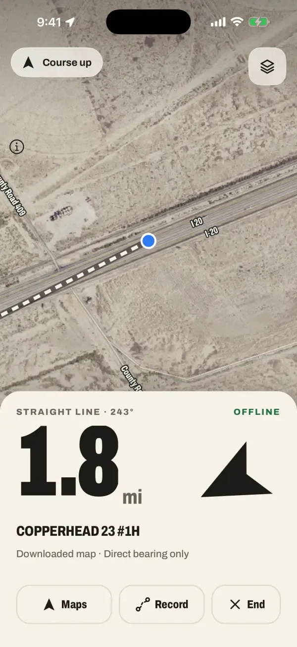
Drive mode in the app: 1.8 miles in a straight line at a bearing of 243 degrees to the well COPPERHEAD 23 #1H, working offline.

Download a county's public well records and maps once. Search by lease, operator, well name or API number. Get distance and compass bearing to the pad with no cell signal.

Download on the App Store

Free to startiPhone · Android coming later

4.7M public well records · 30 states · No account

Built for lease roads, not highways.

Maps that work at zero bars

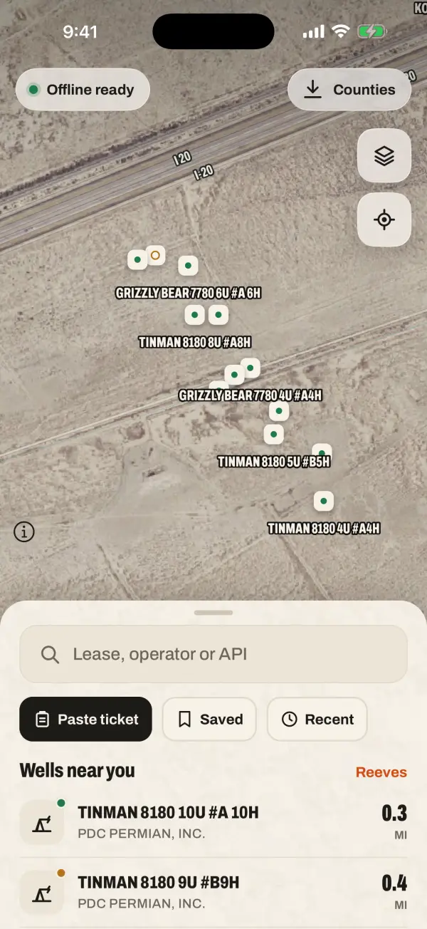
Download a county once, on Wi-Fi or at the yard. Well records stay on your phone for every county. Offline roads and satellite imagery cover the 200+ busiest oilfield counties in 19 states, from the Permian and Eagle Ford to the Bakken and Appalachia; the county list shows which counties include maps before you download.

  • Wells
  • Roads
  • Satellite
Caliche map screen showing labeled wells on satellite imagery with an Offline ready badge.

Search it the way the ticket reads

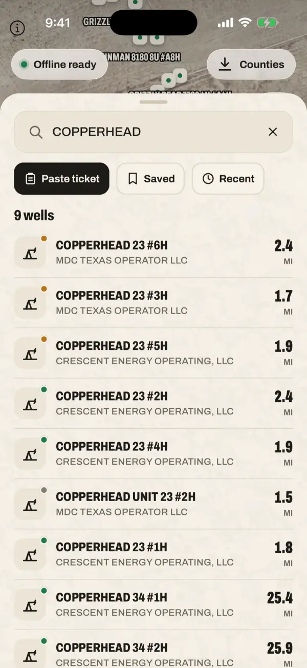
Lease name, operator, well name or API number. Paste a dispatch text and Caliche finds the well it names.

  • 42-389-34383
  • COPPERHEAD 23
  • Paste ticket
Search results for COPPERHEAD listing nine wells with operator names and distances in miles.

Distance and bearing, straight to the pad

Drive mode shows straight-line distance and compass bearing to the well. It is not turn-by-turn. When you need paved-road directions, one tap hands off to Apple Maps or Google Maps.

Distance
1.8 MI
Bearing
243° SW
Signal
NONE
Drive mode showing 1.8 miles in a straight line at 243 degrees to COPPERHEAD 23 #1H, with Maps, Record and End buttons.

Pad notes your crew can seePRO

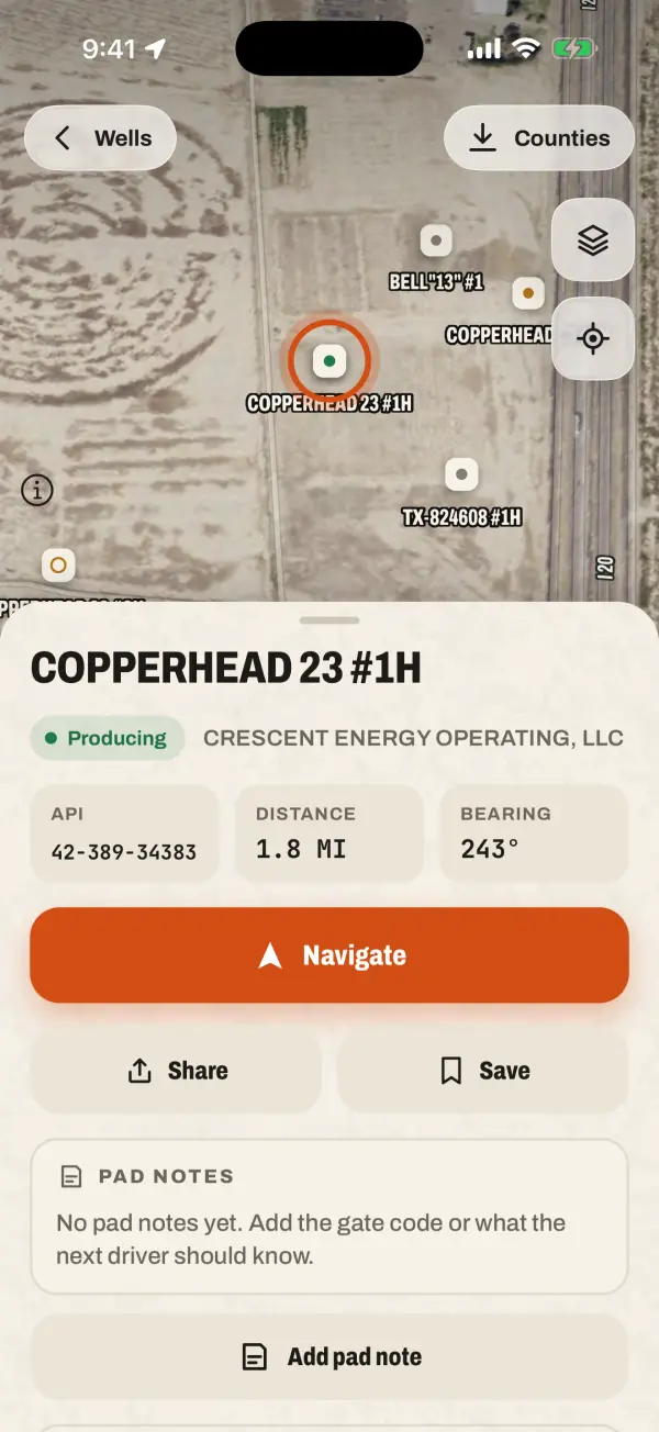
Leave the gate code, a photo of the turn-off or a soft-sand warning on the well. Share a 6-character crew code and everyone on it sees the same notes. Private notes stay yours.

Well details for COPPERHEAD 23 #1H: producing status, API number, distance, bearing, Navigate button and a Pad notes section.
Example note

Gate 4412 Crew

Second cattle guard past the tank battery, then left. Soft sand after rain.

  • Locked gate
  • Soft sand
  • Cattle guard

Crew codeK7Q2MX

Three steps, then drive.

  1. Pick your county

    Search by county name or state code (TX). Your first county is free.

  2. Download it once

    On Wi-Fi or a good signal. Wells and maps go on the phone.

  3. Drive to the pad

    Find the well, follow the bearing. Hand off to Maps for the paved part.

Free to start. Pro when the job grows.

Works with no signal, no login, half the price.

Free

$0

  • One county, downloaded for offline
  • Search by lease, operator, well name or API
  • Well details and saved wells
  • Drive compass: distance and bearing

Caliche Pro

  • Unlimited counties
  • Record and share lease-road routes
  • Crews with a 6-character code
  • Pad notes with photos, synced to your crew
Annual
$79per year
Monthly
$9.99per month
24-hour passOne job, no renewal
$1.9924 hours

US prices on the App Store. Subscriptions renew until you cancel in your Apple account. If Pro ends, counties you already downloaded stay on your phone.

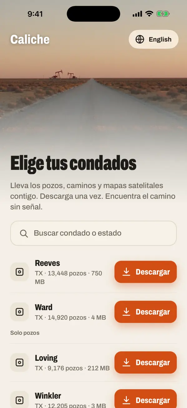
Hablamos español.

The whole app works in Spanish: search, well details, pad notes and Drive mode. Switch languages in the app any time.

The county picker in Spanish: Elige tus condados, with Reeves, Ward, Loving and Winkler counties ready to download.

Questions from the field

Where does the well data come from?

Public records published by state oil and gas agencies, such as the Texas Railroad Commission. Caliche covers about 4.7 million wells across 30 states and is not affiliated with any agency.

How accurate are the locations?

As accurate as the public record, and records are not always right. Coverage varies by county and can be incomplete or out of date. Verify the location, your access permission and the route before you travel. Not for emergency use.

Do I need an account?

No. No sign-up and no login. Open the app and pick a county. Crews connect with a 6-character code, not an account.

Does it really work with no signal?

Yes, once the county is downloaded. GPS does not need cell service, so search, the map and the Drive compass all work offline. Offline roads and satellite imagery are in the 200+ busiest oilfield counties; other counties are wells-only for now. Downloading counties and syncing crew notes need a connection.

Does it give turn-by-turn directions?

No. Caliche shows straight-line distance and compass bearing to the well. For road directions, tap Maps to open Apple Maps or Google Maps.

Is there an Android version?

Not yet. Caliche is on iPhone now, and Android is coming later.

How do I cancel Pro?

Any time, from your subscriptions in your Apple account. The 24-hour pass never renews.

Your first county is free.

Download on the App Store

Free to startiPhone · Android coming later